ფაილი:Kingdom of Kartli-Kakheti in the Map of Caucasus with the borders 1801-1813.png

ზომა წინასწარი გადახედვისას: 679 × 600 პიქსელი. სხვა გაფართოება: 272 × 240 პიქსელი | 543 × 480 პიქსელი | 869 × 768 პიქსელი | 1 159 × 1 024 პიქსელი | 1 286 × 1 136 პიქსელი.
თავდაპირველი ფაილი ((1 286 × 1 136 პიქსელი, ფაილის ზომა: 2,55 მბ, MIME ტიპი: image/png))
| ეს ფაილი მდებარეობს Wikimedia Commons სერვერზე. იხილეთ მისი აღწერის გვერდი სრული ინფორმაციისთვის. |
 |
გადასვლა ფაილის გვერდზე |
| აღწერა |
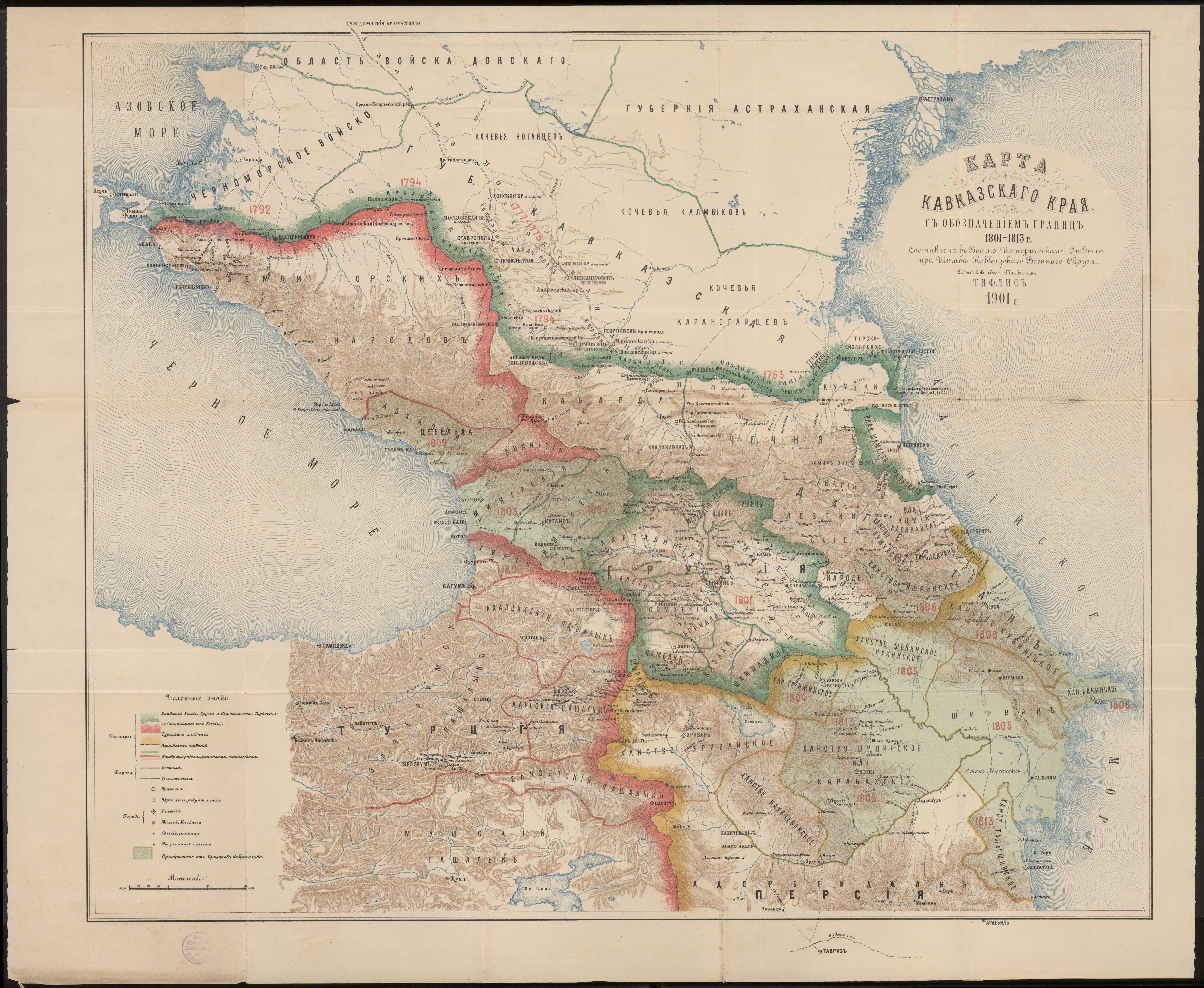
English: Kingdom of Kartli-Kakheti in the Map of Caucasus with the borders 1801-1813.png |
| თარიღი | |
| წყარო | Карта Кавказского края с обозначением границ 1801-1813 г. Составлена в военно-историческом отделе при штабе Кавказского военного округа подполковником Томкиевым. Тифлис 1901 г. |
| ავტორი | Томкиев |
| სხვა ვერსიები |
|

|
This work is in the public domain in its country of origin and other countries and areas where the copyright term is the author's life plus 70 years or fewer. | |
| This file has been identified as being free of known restrictions under copyright law, including all related and neighboring rights. | |
ფაილის ისტორია
დააწკაპუნეთ თარიღზე/დროზე ფაილის დასათვალიერებლად, როგორც ის მაშინ გამოიყურებოდა.
| თარიღი/დრო | მინიატიურა | ზომები | მომხმარებელი | შენიშვნა | |
|---|---|---|---|---|---|
| მიმდინარე | 15:57, 30 ოქტომბერი 2015 | | 1 286×1 136 (2,55 მბ) | Surprizi | User created page with UploadWizard |
ბმულები
ამ ფაილზე ბმული მოცემულია შემდეგ გვერდებზე:
ფაილის გლობალური გამოყენება
ეს ფაილი გამოიყენება შემდეგ ვიკებში:
- გამოყენება en.wiki.x.io-ში
- გამოყენება ru.wiki.x.io-ში
- გამოყენება uk.wiki.x.io-ში
- გამოყენება xmf.wiki.x.io-ში